
 |
 |
||||||||
| Dursley | |||
|
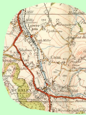
Dursley is a little market town situated approximately 12
miles southwest of the city of Gloucester in a wooded valley under
the edge of the Cotswold escarpment. The surrounding countryside is truly
wonderful providing spectacular views from Stinchcombe Hill west across
the River Severn to Wales, northwest towards the Malverns and south towards
Bristol. Overlooking Dursley itself is the conical shape of Cam Peak which
together with Cam Long Down serve as a public amenity for local residents
and the many walkers who pass through the area. Both of these two hills
together with Stinchcombe Hill and Dursley town centre itself are situated
on the Cotswold Way, the long-distance footpath which links Bath and Chipping
Campden. |
|||
|
|
 |
||
|
Across the road from the Market House is St. James Church which dominates the town centre. At one time the entrance to the church was though a narrow gate and passageway between two buildings and apart from the tower it was effectively hidden. In the late 1950's and 1960's however, much demolition took place within the town centre which opened up the frontage. This demolition, together with removal of other buildings which crowded the Market House and others along Parsonage Street unfortunately took away several of the town's older buildings which in retrospect would have retained character. That said however, there are still many buildings of merit, especially along Long Street which descends to the fine 16th century Priory. At one time, Dursley had its own central railway station which was located at the bottom of Long Street close to the vast site of the R.A.Lister company, world-famous manufacturer of engines and all kinds of agricultural implements. The other major manufacturer in the town was Mawdsley's, who have now unfortunately left their site on Uley Road. For anyone keen on cartographical history there are a number of old maps of the town detailing change over the last 100 years. |
|||