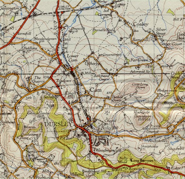
| Although
published in 1946 this map was only fully revised in 1930 with some subsequent
revisions which would explain some of the anomalies shown and the comparative
lack of progress when compared with the 1933
map. As an example, the L.J. Watts estate off Kingshill Road, is not
indicated, even though it was built in 1936. The Highfields estate off Uley
Road is shown however and in Cam, the track locally known as the "Ash
Path", now Everlands, appears as a proper road. Kingshill Estate is
also seen as diminishing along with the fortunes of the house. |