
|
|||||||||
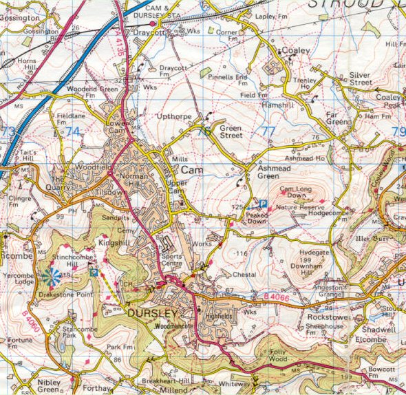
| Dursley and Cam - Ordnance Survey Map, 1 inch to 1 mile (1998) | ||
 |
||
|
Reproduced by kind permission of Ordnance Survey. © Crown Copyright NC/02/3723. Development on a large scale is the order of the day, with new building showing in the Boulton Lane/Henlow Drive area and on Yellow Hundred, Ewelme Close and St. George's Road. In Cam, most of Tilsdown, Norman Hill and the Manor Avenue localities are built up and Cam & Dursley Railway Station is shown as open on the main Bristol to Gloucester line. |
||